Log in
All resources
Create a design
Tools
7,171 Free Images of Atlas Map
joan blaeu
copper engraving print
british library
maps from university of amsterdam special collections
copperplate print
special collections of the university of amsterdam
atlas der neederlanden
atlas maior, vol 3 (germany) - joan blaeu, 1667 - bl 114.h(star).3
maps by isaak tirion
isaak tirion
nieuwe en beknopte hand-atlas (1754)
nieuwe en beknopte hand-atlas (1754)
catalan atlas, 1959 reproduction
nieuwe en beknopte hand-atlas (1754)
nieuwe en beknopte hand-atlas (1754)
old county maps of oxfordshire
bodleian maps collection
gemeente atlas van nederland - south holland
maps of hazerswoude
gemeente atlas van nederland - north brabant
bokhoven
atlas maior, vol 3 (germany) - joan blaeu, 1667 - bl 114.h(star).3
copper engraving print
atlas maior, vol 3 (germany) - joan blaeu, 1667 - bl 114.h(star).3
copper engraving print
atlas maior, vol 3 (germany) - joan blaeu, 1667 - bl 114.h(star).3
copper engraving print
atlas maior, vol 3 (germany) - joan blaeu, 1667 - bl 114.h(star).3
copper engraving print
atlas maior, vol 3 (germany) - joan blaeu, 1667 - bl 114.h(star).3
copper engraving print
atlas maior, vol 3 (germany) - joan blaeu, 1667 - bl 114.h(star).3
copper engraving print
atlas maior, vol 3 (germany) - joan blaeu, 1667 - bl 114.h(star).3
copper engraving print
atlas maior, vol 3 (germany) - joan blaeu, 1667 - bl 114.h(star).3
copper engraving print
atlas maior, vol 3 (germany) - joan blaeu, 1667 - bl 114.h(star).3
copper engraving print
atlas maior, vol 3 (germany) - joan blaeu, 1667 - bl 114.h(star).3
copper engraving print
atlas maior, vol 3 (germany) - joan blaeu, 1667 - bl 114.h(star).3
copper engraving print
atlas maior, vol 3 (germany) - joan blaeu, 1667 - bl 114.h(star).3
copper engraving print
atlas maior, vol 3 (germany) - joan blaeu, 1667 - bl 114.h(star).3
copper engraving print
atlas maior, vol 4 (netherlands) - joan blaeu, 1667 - bl 114.h(star).4
copper engraving print
atlas maior, vol 2 (sweden, russia, poland, eastern europe, and greece) - joan blaeu, 1667 - bl 114.h(star).2
copper engraving print
gemeente atlas van nederland - north holland
old maps of enkhuizen
gemeente atlas van nederland - north holland
maps of marken (waterland)
maps from géographie illustrée de la france et de ses colonies
orientalist painting
media from regionaal archief alkmaar
schermerhorn
media from regionaal archief alkmaar
oterleek
maps of the caribbean by mercator-hondius
details of old maps
1801 maps of germany
maps by john cary
17th-century maps of thuringia
atlas novus (blaeu)
1640s maps of bavaria
atlas novus (blaeu)
old maps of brielle
atlas van loon
maps from university of amsterdam special collections
caartboeck van voorne, 1701
gemeente atlas van nederland - south holland
1860s maps of south holland
1640s maps of abkhazia
1640s maps of georgia
1800s maps of the iberian peninsula
maps by john cary
gemeente atlas van nederland - south holland
maps of veur
gemeente atlas van nederland - south holland
1860s maps of south holland
old maps of utrecht
atlas novus (blaeu)
gemeente atlas van nederland - north holland
maps of jisp
gemeente atlas van nederland - north holland
old maps of monnickendam
gemeente atlas van nederland - north holland
old maps of purmerend
historical
history
atlas maior, vol 2 (sweden, russia, poland, eastern europe, and greece) - joan blaeu, 1667 - bl 114.h(star).2
copper engraving print
atlas maior, vol 3 (germany) - joan blaeu, 1667 - bl 114.h(star).3
copper engraving print
atlas maior, vol 3 (germany) - joan blaeu, 1667 - bl 114.h(star).3
copper engraving print
atlas maior, vol 4 (netherlands) - joan blaeu, 1667 - bl 114.h(star).4
copper engraving print
atlas maior, vol 3 (germany) - joan blaeu, 1667 - bl 114.h(star).3
copper engraving print
atlas maior, vol 3 (germany) - joan blaeu, 1667 - bl 114.h(star).3
copper engraving print
atlas maior, vol 3 (germany) - joan blaeu, 1667 - bl 114.h(star).3
copper engraving print
atlas maior, vol 3 (germany) - joan blaeu, 1667 - bl 114.h(star).3
copper engraving print
atlas maior, vol 3 (germany) - joan blaeu, 1667 - bl 114.h(star).3
copper engraving print
atlas maior, vol 3 (germany) - joan blaeu, 1667 - bl 114.h(star).3
copper engraving print
atlas maior, vol 3 (germany) - joan blaeu, 1667 - bl 114.h(star).3
copper engraving print
atlas maior, vol 3 (germany) - joan blaeu, 1667 - bl 114.h(star).3
copper engraving print
atlas maior, vol 4 (netherlands) - joan blaeu, 1667 - bl 114.h(star).4
copper engraving print
atlas maior, vol 4 (netherlands) - joan blaeu, 1667 - bl 114.h(star).4
copper engraving print
atlas maior, vol 3 (germany) - joan blaeu, 1667 - bl 114.h(star).3
copper engraving print
media from regionaal archief alkmaar
schoorl
media from regionaal archief alkmaar
limmen
maps from university of amsterdam special collections
atlas der neederlanden
maps from university of amsterdam special collections
atlas der neederlanden
maps from university of amsterdam special collections
atlas der neederlanden
maps from university of amsterdam special collections
atlas der neederlanden
maps from university of amsterdam special collections
atlas der neederlanden
maps from university of amsterdam special collections
atlas der neederlanden
maps from university of amsterdam special collections
atlas der neederlanden
maps from university of amsterdam special collections
atlas der neederlanden
maps from university of amsterdam special collections
atlas der neederlanden
maps from university of amsterdam special collections
atlas der neederlanden
old maps of limburg, netherlands
1884 in limburg (netherlands)
1800s maps of czechia
maps by john cary
maps from university of amsterdam special collections
atlas der neederlanden
maps from university of amsterdam special collections
atlas der neederlanden
claes jansz. visscher (ii)
atlas van stolk
maps from university of amsterdam special collections
atlas der neederlanden
coats of arms of austrian silesia
atlas maior
1804 maps of europe
maps by john cary
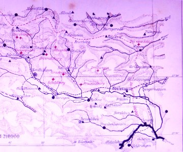
gemeente atlas van nederland - gelderland
varsseveld
atlas minor gerardi mercatoris (1621, maps)
maps of provence by pierre-jean de bompar
gemeente atlas van nederland - north holland
19th-century maps of den helder
gemeente atlas van nederland - south holland
1860s maps of south holland
nieuwe en beknopte hand-atlas (1754)
nieuwe en beknopte hand-atlas (1754)
atlas der neederlanden deel ii: holland 1. zuid-holland
maps from university of amsterdam special collections
maps in the library of congress
1721 maps
1663 maps
baroque
maps from university of amsterdam special collections
atlas der neederlanden
maps from university of amsterdam special collections
atlas der neederlanden
maps from university of amsterdam special collections
atlas der neederlanden
maps from university of amsterdam special collections
atlas der neederlanden
maps from university of amsterdam special collections
atlas der neederlanden
maps from university of amsterdam special collections
atlas der neederlanden
maps from university of amsterdam special collections
atlas der neederlanden
maps from university of amsterdam special collections
atlas der neederlanden
maps from university of amsterdam special collections
atlas der neederlanden
maps from university of amsterdam special collections
atlas der neederlanden
maps from university of amsterdam special collections
atlas der neederlanden
maps from university of amsterdam special collections
atlas der neederlanden
2901 - 3000 of 7,171
Next page
/ 72


![[Oxfordshire by Thomas Kitchen], Thomas Kitchin, 1750](https://cdn.creazilla.com/illustrations/10001146500/oxfordshire-by-thomas-kitchen-thomas-kitchin-1750-sm.jpg)


![Caarte vande polder van Rugge A° 1696 / Heyman van Dyck fecit; A. Steyaart invenit; I. Stemmers sculpsit; I. Luiken fecit cum aqua forti, Romeyn de Hooghe, [1701]](https://cdn.creazilla.com/illustrations/10001404604/caarte-vande-polder-van-rugge-a-1696-heyman-van-dyck-fecit-a-steyaart-invenit-i-stemmers-sculpsit-i-luiken-fecit-cum-aqua-forti-romeyn-de-hooghe-1701-md.jpg)


![New map of the dike county of Dregterlandt MDCCXXIII / [Govert Oostwoudt], Hendrik de Leth, 1723](https://cdn.creazilla.com/illustrations/10001164306/new-map-of-the-dike-county-of-dregterlandt-mdccxxiii-govert-oostwoudt-hendrik-de-leth-1723-md.jpg)
![New map of the dike county of Dregterlandt MDCCXXIII / [Govert Oostwoudt], Hendrik de Leth, 1723](https://cdn.creazilla.com/illustrations/10001513549/new-map-of-the-dike-county-of-dregterlandt-mdccxxiii-govert-oostwoudt-hendrik-de-leth-1723-md.jpg)
![Map of Hindustan - Bellin, Jakob van der Schley, [1752]](https://cdn.creazilla.com/illustrations/10001359833/map-of-hindustan-bellin-jakob-van-der-schley-1752-md.jpg)
![New map of the dike county of Dregterlandt MDCCXXIII / [Govert Oostwoudt], Hendrik de Leth, 1723](https://cdn.creazilla.com/illustrations/10000268352/new-map-of-the-dike-county-of-dregterlandt-mdccxxiii-govert-oostwoudt-hendrik-de-leth-1723-md.jpg)


![Special map of a part of Dutch Brabant, Guelders and Cleves or the surroundings of Grave, Ravestein, Helmont, Nijmegen, Fort de Schenk, Cleves, Gennip, Emmerick &c. / I. Condet f. 1748, Johannes Condet, [1748]](https://cdn.creazilla.com/illustrations/10000963180/special-map-of-a-part-of-dutch-brabant-guelders-and-cleves-or-the-surroundings-of-grave-ravestein-helmont-nijmegen-fort-de-schenk-cleves-gennip-emmerick-c-i-condet-f-1748-johannes-condet-1748-sm.jpg)
![Persian and Indian Ocean Coastline Map (1740), Jakob van der Schley, [1773]](https://cdn.creazilla.com/illustrations/10000761796/persian-and-indian-ocean-coastline-map-1740-jakob-van-der-schley-1773-sm.webp)


![Map of the Ring of Putten, Gilliam van der Gouwen, [1701]](https://cdn.creazilla.com/illustrations/10001174499/map-of-the-ring-of-putten-gilliam-van-der-gouwen-1701-md.jpg)


![Gulf of Mexico Map - *J. v. Schley & Bellin Marine Engraving*, Jakob van der Schley, [1773]](https://cdn.creazilla.com/illustrations/10000578116/gulf-of-mexico-map-j-v-schley-bellin-marine-engraving-jakob-van-der-schley-1773-md.jpg)


![Persian and Indian Ocean Coastline Map (1740), Jakob van der Schley, [1773]](https://cdn.creazilla.com/illustrations/10001190018/persian-and-indian-ocean-coastline-map-1740-jakob-van-der-schley-1773-md.jpg)
![New map of the dike county of Dregterlandt MDCCXXIII / [Govert Oostwoudt], Hendrik de Leth, 1723](https://cdn.creazilla.com/illustrations/10001193208/new-map-of-the-dike-county-of-dregterlandt-mdccxxiii-govert-oostwoudt-hendrik-de-leth-1723-md.jpg)


![Carte des environs de Batavia = Map of the outskirts of Batavia / J. v. Schley direct, Jakob van der Schley, [1755]](https://cdn.creazilla.com/illustrations/10001436890/carte-des-environs-de-batavia-map-of-the-outskirts-of-batavia-j-v-schley-direct-jakob-van-der-schley-1755-md.jpg)

